Mon parcours

BureauChris
User
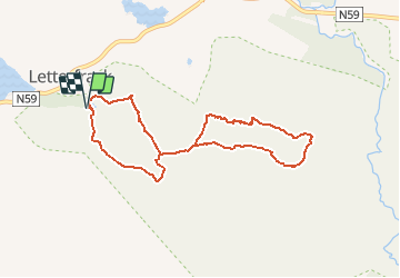

Length
7.1 km

Max alt
424 m

Uphill gradient
366 m
Km-Effort
12 km

Min alt
51 m

Downhill gradient
366 m
Boucle
Yes
Creation date :
2019-08-01 19:03:15.098
Updated on :
2021-04-04 16:45:52.121
2h26
Difficulty : Medium

FREE GPS app for hiking
 SityTrail
IGN / Geographical institutes
SityTrail Plus
The world is yours!
About
Trail Walking of 7.1 km to be discovered at Unknown, County Galway, Conamara Municipal District. This trail is proposed by BureauChris.
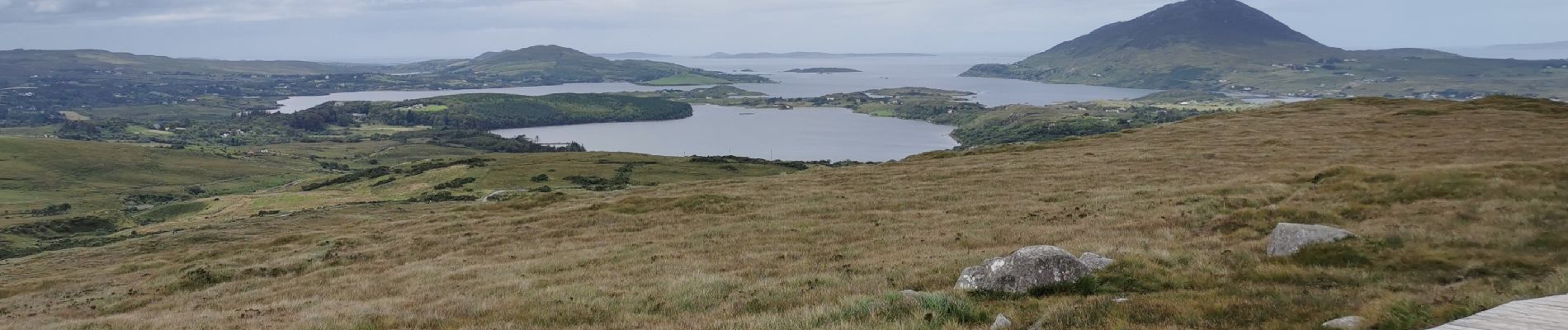
Photos

Positioning
Country:
Ireland
Region :
Unknown
Department/Province :
County Galway
Municipality :
Conamara Municipal District
Location:
Ballynakill Electoral Division
Start:(Dec)
Start:(UTM)
437356 ; 5933925 (29U) N.
Comments